
Analysis
01 - 10 - 2026
SatLeo Aims to Turn Heat into Space-Based Intelligence
As Ahmedabad-based SatLeo Labs prepares to send TAPAS-1 aboard SpaceX’s Transporter-18, the startup is betting that thermal data—not another conventional image—could become the next layer of commercial Earth observation
There is a simple way to understand what SatLeo Labs is trying to do from space: imagine giving the Earth a thermometer.
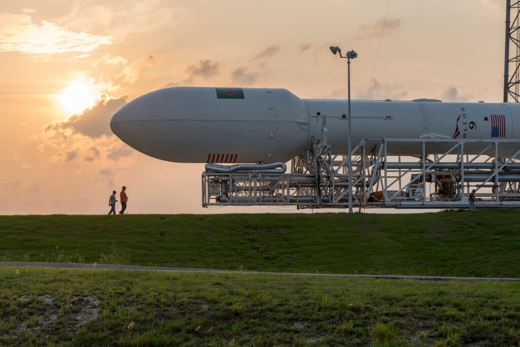
At about 11:48 pm IST on October 1, the Ahmedabad-based space startup is scheduled to send TAPAS-1 into orbit aboard SpaceX’s Falcon 9 as part of the Transporter-18 rideshare mission from Vandenberg Space Force Base in California. The launch is being facilitated through Dhruva Space’s LEAP-2 platform. SpaceX has scheduled Transporter-18 for 11:18 a.m. Pacific Time, with a 58-minute launch window, and says the dedicated rideshare mission is carrying 130 payloads.
For SatLeo, however, the importance of the launch is not simply that another Indian-built payload is heading into orbit. It is about what the company wants that payload to measure.
TAPAS-1—short for Thermal Access Platform for Analytics & Solutions—is a CubeSat-category thermal payload designed to demonstrate and validate SatLeo’s thermal sensing and data-processing capabilities in orbit. The company describes it as India’s first dedicated commercial thermal payload.
The underlying proposition is straightforward: conventional optical satellites largely tell us what the Earth looks like. Thermal infrared sensors can provide information about how hot different parts of the Earth are.
“Most satellites show us what the Earth looks like, TAPAS-1 will show us how it behaves by revealing temperature patterns that ordinary payloads cannot see,” said Shravan Bhati, co-founder and CEO of SatLeo Labs.
SatLeo co-founder and Chief Strategy Officer Urmil Bakhai frames the concept even more simply: “We like to say our planet has a fever, and the first thing you do with a fever is measure it.”
That distinction could become increasingly important as heatwaves, drought, wildfires, water stress and overheating infrastructure become operational problems for farmers, cities, utilities, insurers and governments—not just subjects for climate researchers.
Reading temperature instead of taking pictures
Earth observation has traditionally been built around imagery. Satellites photograph farms, cities, forests, coastlines and industrial facilities, and customers interpret those images for particular applications.
SatLeo is attempting to move one step further downstream. A farmer may not need a thermal image as such. The useful product could be an indication that a particular portion of a field is experiencing water stress and requires irrigation.
A municipal authority may not need a temperature map for its own sake. It may need to know which neighbourhoods are becoming dangerous during a heatwave, where cooling interventions should be concentrated or which populations require an early warning.
The company is therefore positioning TAPAS-1 not simply as a sensor demonstration but as the first orbital component of what it calls a thermal intelligence platform.
Its own website describes applications ranging from identifying heat islands and overheating infrastructure to detecting temperature anomalies, crop stress and irrigation requirements.
The distinction between data and intelligence is central to the business model. SatLeo does not ultimately want its customers to buy pictures. It wants them to buy answers derived from measurements.
Technology challenge
Thermal infrared sensing measures radiation associated with the temperature of objects and surfaces. That makes it fundamentally different from conventional visible-light imaging, where satellites primarily measure reflected sunlight.
The advantage is particularly relevant after sunset. Thermal observations do not depend on sunlight in the same way optical imagery does, allowing temperature-related changes to be observed through both day and night.
But thermal Earth observation also brings its own technical challenges. Atmospheric conditions, surface properties, calibration, spatial resolution and the distinction between land-surface temperature and air temperature all affect how the data can be interpreted.
That means the first task for TAPAS-1 is not to prove that Earth is measurable from space. It is to demonstrate that SatLeo can produce reliable, calibrated and commercially useful thermal information from its own orbital system.
SatLeo says it has already tested applications of thermal intelligence using combinations of existing satellite imagery, drones and Internet-of-Things data.
In Tumakuru, Karnataka, the company used thermal monitoring to study a roughly 40-acre solid-waste landfill and identify areas associated with methane build-up and greenhouse-gas emissions, according to Bakhai.
In Ahmedabad, the company has worked with the municipal corporation on ward-level urban-heat mapping and three-day forecasts. SatLeo says those forecasts achieved an accuracy of approximately 2–3°C and that QR-code-based advisories were used to help outdoor workers and citizens identify heat-prone areas.
These projects did not use TAPAS-1. They were terrestrial and multi-source demonstrations of the applications SatLeo wants eventually to support with proprietary satellite observations.
The company says its super-resolution algorithms combined open satellite data, drone observations and IoT information, with reported accuracy of roughly 70–75%. It expects that performance to improve substantially when proprietary satellite data becomes available.
Those claims will need to be demonstrated through operational data. But the development strategy is clear: test the applications on the ground first, then build a proprietary space-based data source around them.
Agriculture is first major market
Agriculture is one of the clearest applications.
Plants can experience heat and water stress before visible signs of damage become obvious. Thermal information can therefore potentially help identify stressed areas, improve irrigation decisions and support crop-health monitoring.
SatLeo says companies including Cropin and BayWa have expressed interest in using its data for crop health, advisories and yield estimation.
The commercial proposition depends heavily on temporal frequency. A single satellite can observe a particular location only when it passes overhead. A constellation can transform that occasional observation into a much more regular data stream.
That is why TAPAS-1 is only the first step in SatLeo’s roadmap. The real business case is a constellation
SatLeo plans a constellation of approximately 12–15 satellites, with its larger PYRO platform intended to provide substantially more frequent thermal observations.
The company says a constellation of around 15 satellites could enable approximately twice-daily revisits of a location. It also intends to use artificial intelligence to help generate insights between observations.
The commercial logic is straightforward: customers requiring continuous monitoring are unlikely to build their businesses around occasional satellite images. They need a recurring information service.
“One satellite cannot capture the whole globe, and customers don’t buy a one-off picture; they buy a reliable feed,” Bakhai says. “A constellation turns a data product into infrastructure.”
SatLeo’s current roadmap calls for TAPAS-2 in the second quarter of 2027, its first PYRO satellite in the first quarter of 2028 and the broader constellation by 2029.
Those are company targets rather than demonstrated milestones, and their execution will depend on financing, satellite manufacturing, launch availability, in-orbit performance and the conversion of prospective customers into recurring contracts.
The same thermal capability that could identify crop stress can have applications in security and defence.
Thermal sensing has an obvious operational advantage in darkness, potentially allowing heat signatures to be identified when conventional optical imaging is constrained by the absence of sunlight.
SatLeo says defence could eventually become one of its largest markets and that it has interest from India’s defence and intelligence ecosystem. Some of those discussions, the company says, cannot be disclosed publicly.
That makes defence a potentially significant opportunity, but also one where much of the commercial proposition remains difficult to assess externally until systems are operational and contracts are publicly disclosed.
For now, agriculture and urban heat provide more visible examples of the company’s intended use cases.
Building stack in India
SatLeo’s proposition is also about where the technology is developed. The company says it designs and builds its satellites in India, operates from Ahmedabad and has support from IN-SPACe, with access to ISRO facilities.
The private-space ecosystem has changed significantly in India since the opening of the sector to greater private participation. For startups such as SatLeo, the availability of domestic design, testing, integration and launch-support capabilities can reduce some of the barriers that historically kept space hardware development concentrated within government institutions and a small number of established aerospace companies.
But the launch of TAPAS-1 also illustrates an important reality of the new space economy: an Indian spacecraft does not necessarily need an Indian rocket to reach orbit.
TAPAS-1 is being launched from California on a SpaceX Falcon 9 through a rideshare mission. Transporter-18 is specifically designed to aggregate numerous small spacecraft on a single launch, allowing companies to access orbit without purchasing an entire rocket. SpaceX says the mission is carrying 130 payloads.
For SatLeo, that global launch infrastructure effectively becomes part of the company’s route to market.
The spectacle of launch lasts minutes. The commercial test begins afterwards.
TAPAS-1 has to demonstrate that its thermal sensor works in orbit, that the payload can acquire useful measurements and that SatLeo can convert those measurements into reliable products for customers.
That is considerably harder than producing a visually compelling satellite image.
The company’s longer-term architecture includes processing at different stages, including the possibility of edge AI aboard satellites and analytics on the ground. Its objective is for customers eventually to request information such as a crop-stress alert, a heatwave warning or an infrastructure anomaly rather than simply download an image.
SatLeo’s future PYRO platform is intended to push that concept further. The company says it is targeting sub-10-metre resolution and plans to combine long-wave and mid-wave infrared capabilities with optical sensing.
The proposed constellation therefore represents the more ambitious part of the business. TAPAS-1 is the technology demonstration; PYRO is intended to become the commercial infrastructure.
That distinction may ultimately determine whether SatLeo’s strategy succeeds.
The competitive advantage in commercial Earth observation increasingly lies not only in owning a satellite, but in controlling the entire chain—from sensing and calibration to data processing, analytics and customer-specific applications.
SatLeo is attempting to build precisely that chain around temperature.
Its stated funding, customer pipeline and constellation plans are ambitious, but letters of intent are not the same as realised revenue, and projected accuracy is not the same as independently validated operational performance.
The October 1 mission therefore matters because it moves the company from a largely ground-tested proposition to an orbital one.
If TAPAS-1 performs as intended, SatLeo will have taken the first step towards building a proprietary source of high-resolution thermal data. The larger question will then be whether that data is frequent and reliable enough—and the resulting intelligence valuable enough—for customers to pay for it repeatedly.
That is the real bet behind the company’s “thermometer for Earth” analogy.
The objective is not simply to see a hotter Earth. It is to turn temperature into information, and information into decisions.
By Subramanya Joshi
If you spotted a mistake or have feedback on this story, write to us at editor@newsassociate.com. Email us your press releases on the same ID.
Most Popular
3 days ago
Kotak Mahindra Bank’s profits soar, but margins refuse to join the party
Management expects the full-quarter impact of FCNR(B) deposits to weigh on margins in the…
4 days ago
Infosys Q2 net profit rises 6% to ₹7,823 crore
India's second-largest IT services company trims FY27 revenue guidance

1 day ago
India’s Mumbai records 3,145 luxury property transactions in H1 FY27
The city registered 3,145 luxury residential property transactions worth ₹32,623 crore between April and…

3 days ago
Tech Mahindra partners with SpaceXSI to bring Grok AI coding tools into enterprise workflows
The collaboration will target legacy application modernisation, software development and developer productivity, with a…
